


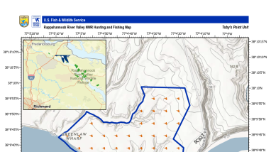
The image is a hunting and fishing map for the Toby's Point Unit of the Rappahannock River Valley National Wildlife Refuge.
- Key Features: The map details the refuge boundary, designated "No Hunting Zones," extensive hunting areas and shoreline waterfowl hunt zones marked with hunter symbols, fishing areas, boat ramps, parking lots, and secondary state routes like Wilmont Rd.
- Geography & Inset: An inset map in the upper-left corner shows the regional context near Fredericksburg, Richmond, and the refuge.
- Metadata: Produced on August 1, 2026, using an ESRI Environment basemap with a WGS 84 Web Mercator projection.
Publication date
Type of document
Map
Media Usage Rights/License
Public Domain